
Location: Hidaka, Saru-gun (Hidaka)
Altitude: 2053m (1400m elevation gain, total elevation gain ~2250m)
Length: 2 days (25km roundtrip)
Hiked on: June 18th – 19th, 2015
**UPDATE**
This hike may not be accessible anymore, so please check the latest conditions before undertaking it. I unfortunately do not have any information at this moment, if you do please feel free to share!
This was the hike on my list this summer. While it happened a bit earlier than I expected, I decided to head over during my week off in late June despite the uncertain snow conditions. The “usual” course for Poroshiri is the Nukabira Course with its famous creek crossings. I decided to bypass all that and approach the hike from the Chiroro Service Road, which begins from the town of Hidaka, further up north from the Nukabira route. It saves you getting your feet wet (I still did) and also takes you through a ridgeline that’s known as the “First Class Highway” of the Hidaka Range. From Route 274 heading towards Obihiro from Hidaka Town, there is a small side road to the right that eventually turns into a gravel road. You pass the Chiroro Gate where there is also a “forest entry register” then the road continues for another little while until you hit a big parking lot with a portable toilet and another gate on the right side. The hike begins there.

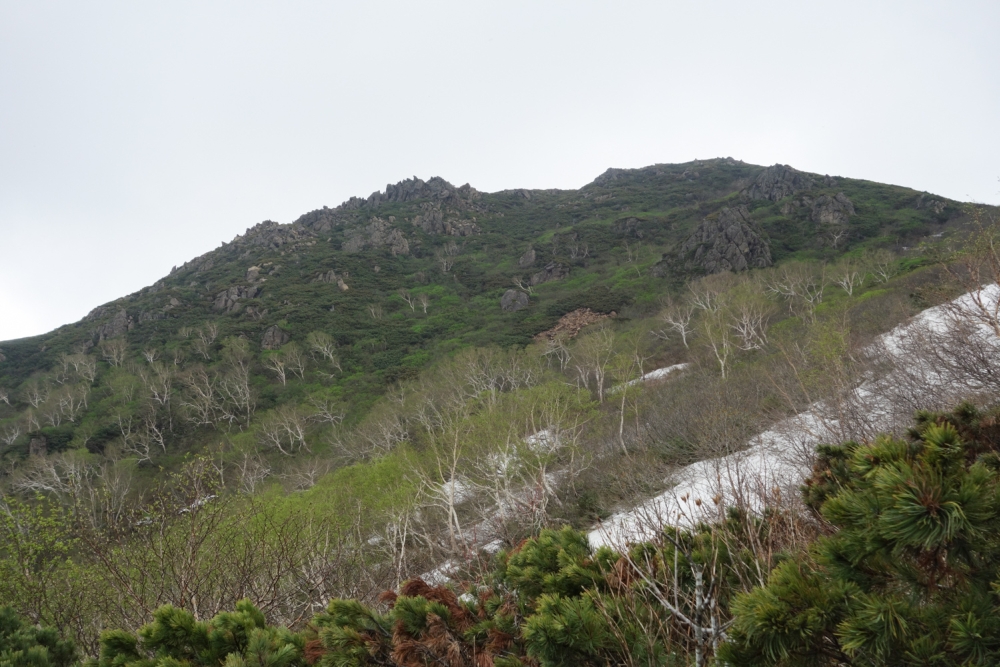
The first section is through another service road, which isn’t nearly as long as I expected it would be. After 45 minutes or so, you get to the real trailhead at the end of the road with a small dam. From there, you walk along a creek for quite a while, making a few crossings. There were a few tricky spots, but they should cause no problems during a dryer part of the year. There were some snow filled spots higher up. Just before you hit a set of cascading waterfalls, you will see a trail off to the right that takes you up to the ridgeline. The climb is steep initially, and the trail very muddy and thus slippery. There is one spot where you can fill up on water just about halfway up. Best to fill up unless you have a way to treat/melt water.
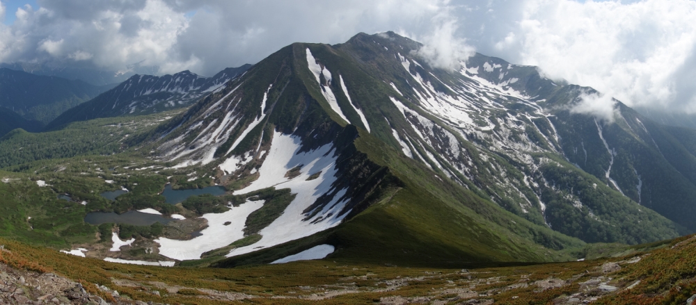
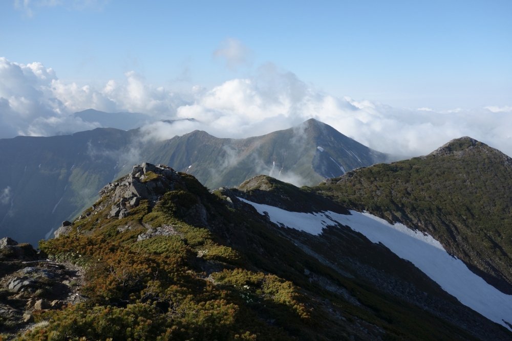
Near the top of a ridge, there was a large section of snow which was a bit confusing. Just try to follow other footsteps, hopefully there are some left. You’ll see a rocky summit up ahead, which is the first peak on the trip, Nukabira-dake. There is no summit sign there, just a triangulation point, so keep walking along the ridge line. The trail climbs up suddenly to reach Kitatottabetsu-dake, where the views suddenly open up, and you are suddenly surrounded by mountains. Kitatottabetsu is a popular spot to camp, with room for 2-3 tents. I continued on, turning right and continuing onto the next peak Tottabetesu-dake, where I set up camp. From Tottabetsu, Poroshiri is staring right in front of you, with the Nanatsunonuma (seven ponds) Cirque to your left. Nanatsunonuma Cirque is also a popular camping spot, which also provides access to water but I’ve heard it can be quite bear-prone so I decided to save it for another day when I’m with more company.


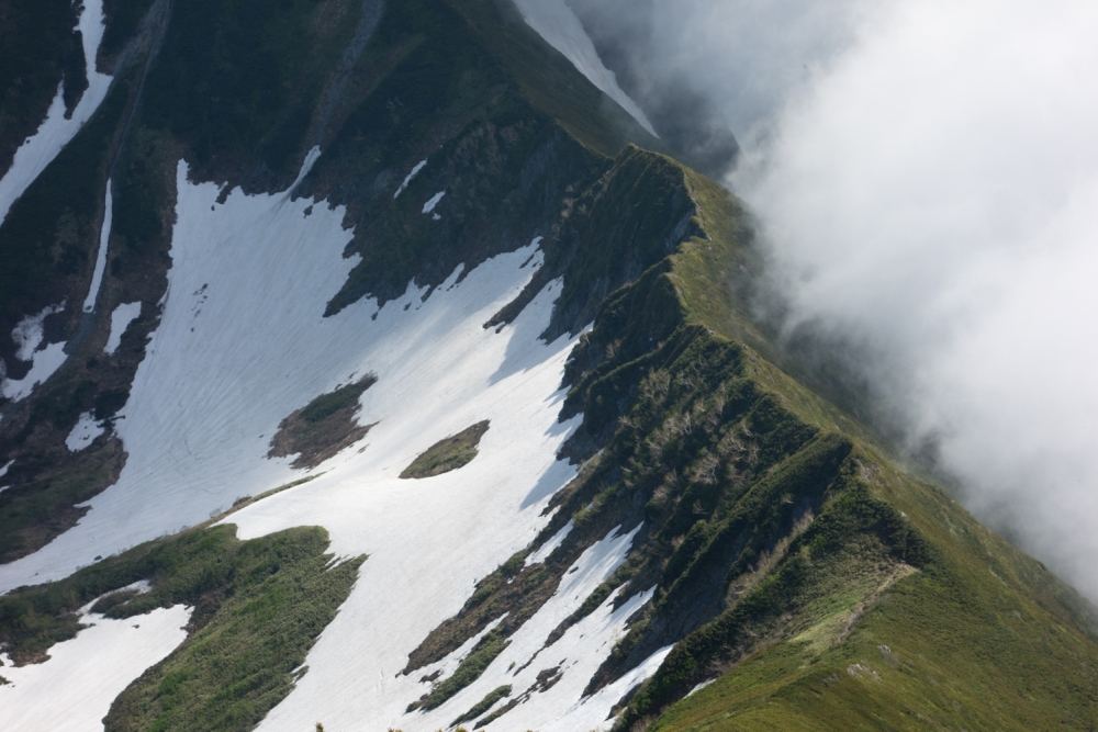
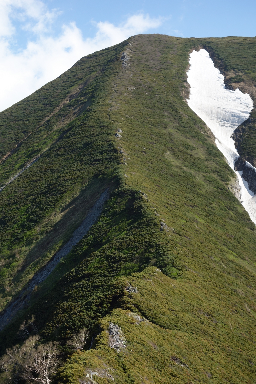
After setting up my tent, I continued on to Poroshiri, which admittedly was further from Tottabetsu than I had initially expected. The trail drops down a fair bit, then you travel over a knife-line ridge before hitting another massive, steep climb up to the upper section of Poroshiri. You certainly don’t get many ridgelines like this one in Hokkaido, and it makes you feel like you’re somewhere in the Northern Alps. Eventually, I got to the summit of Poroshiri, which was again devoid of any people. It’s a big summit, and also has a couple spots where you can set up your tent, if you can manage to lug all your stuff that far. The Hidaka Mountains are one of the few places in Japan with cirques, which are remnants of glaciers in the past, and you can spot many of them from Poroshiri. After a few photos, I hurriedly made my way back to my tent, knowing that the sun will go down and the clouds will be enveloping the mountains soon and went to sleep.

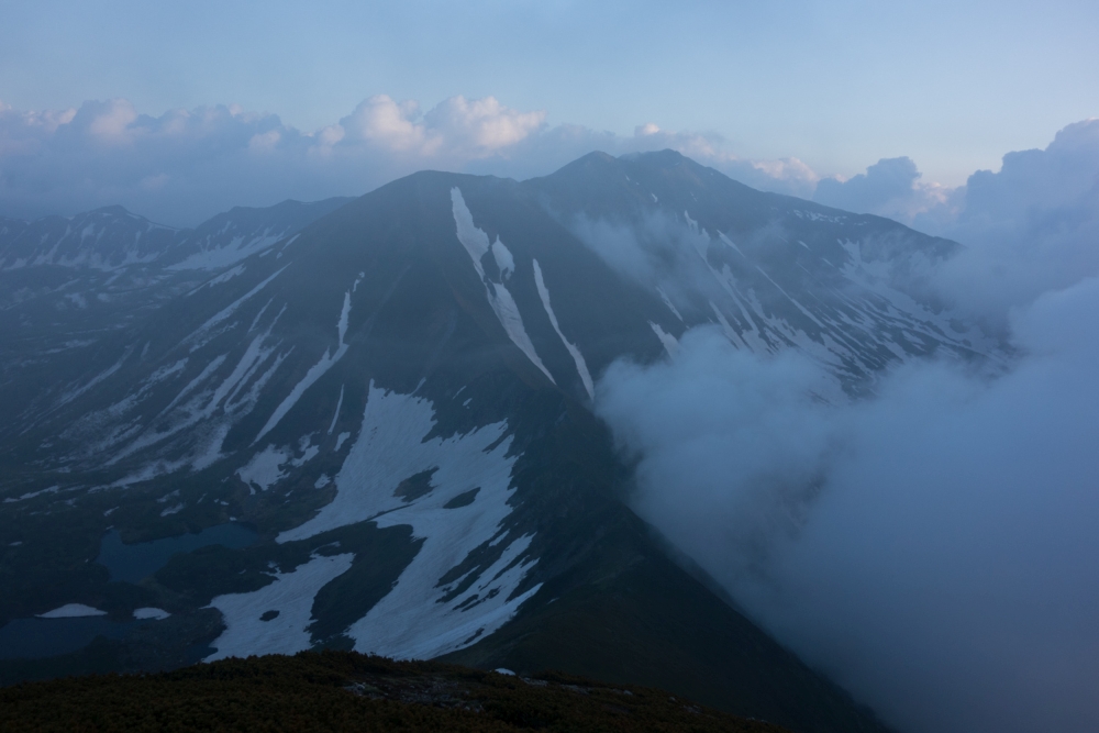
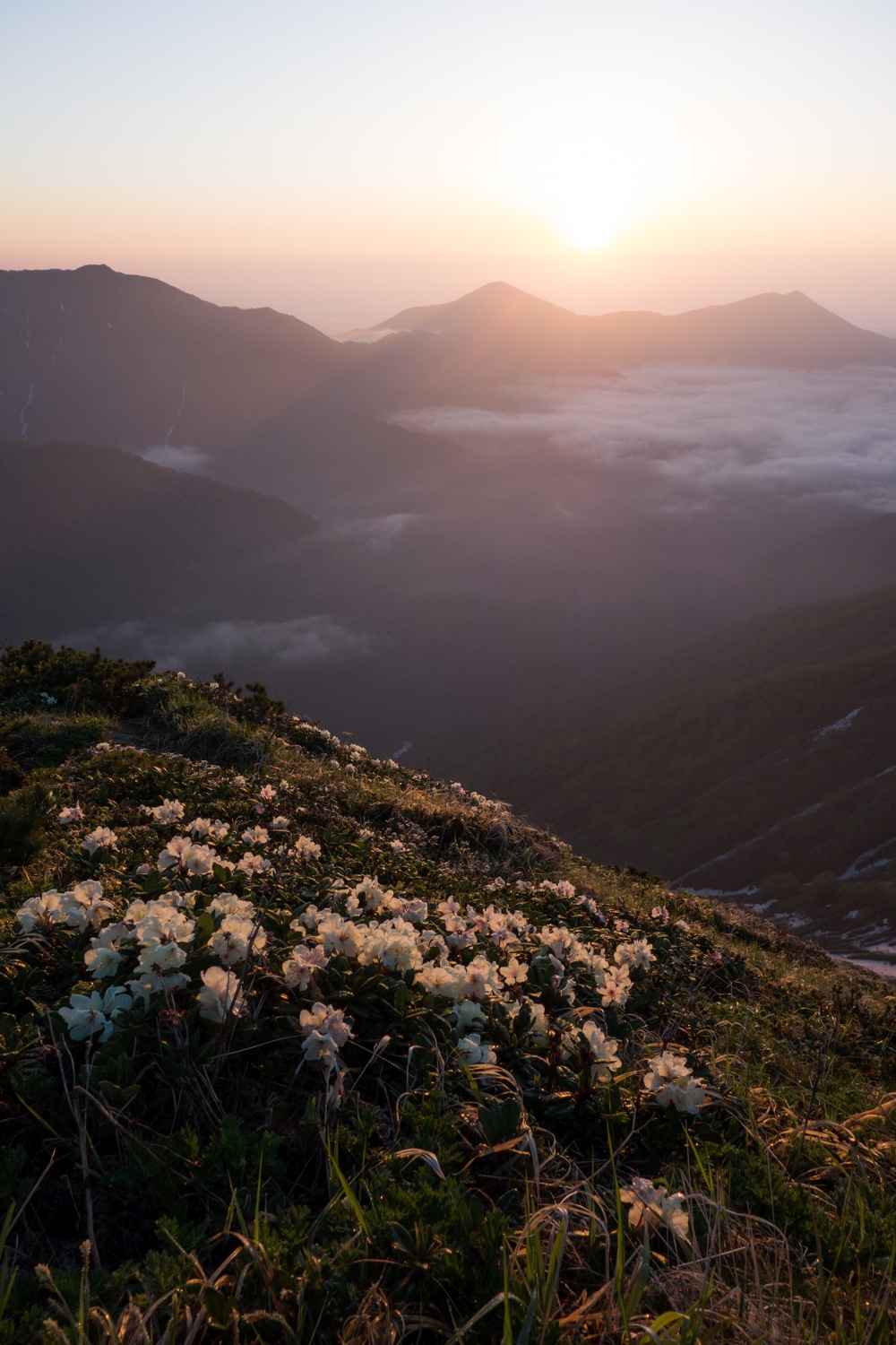
The next morning, I woke up at 4am (just after sunrise!) to admire Poroshiri and the cirques in the early morning light, then went back to sleep for another few hours before heading down. The way back was rough, with all the pine branches now pointing towards me and grabbing at my legs as I struggled to make my way up and down along the ridge. Eventually I managed to make my way down the ridge, the stream, and the service road to get back to my car. Driving back, I still had the image of Poroshiri etched in my mind. It was a rough hike, but I think I will be back for more of what the Hidaka Mountains have to offer.


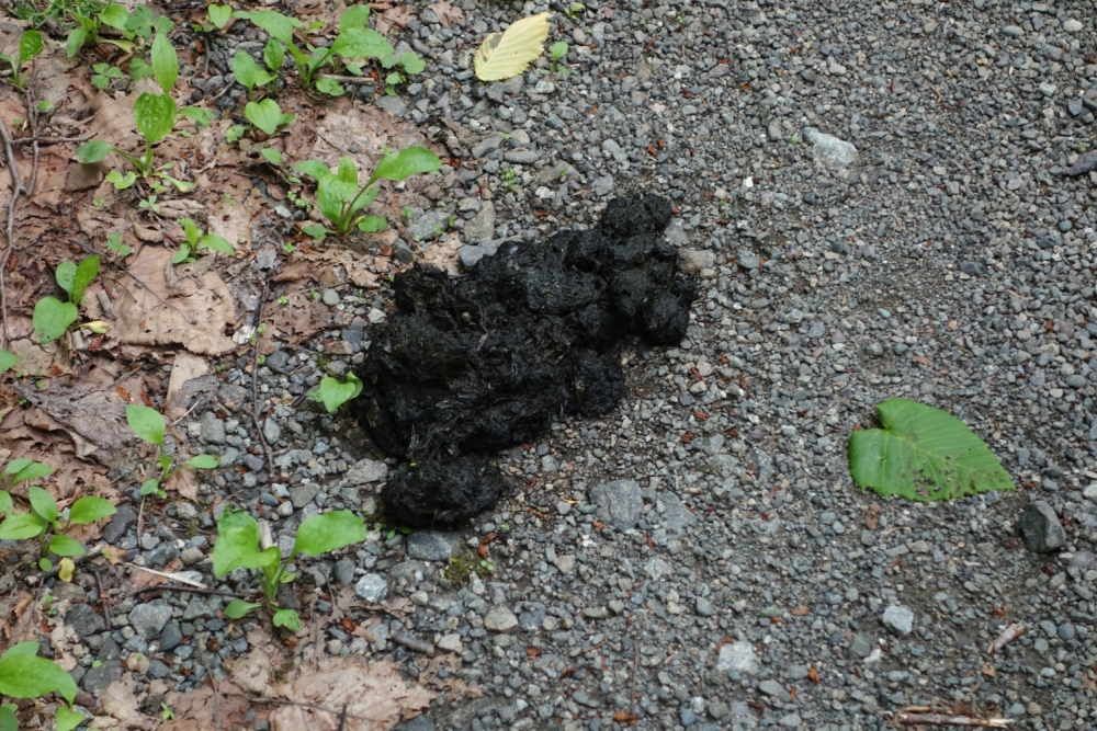
By the way, I didn’t run into any bears, but they are out there, as demonstrated by this pile of turd on the logging road which wasn’t there when I was going up!

Awesome work man. Stunning photos!
LikeLike
Thanks man, you should definitely get out there if you have the chance!
PS Good work on the sea to summit! Showing them how it’s done!
LikeLike
Thank you for an excellent post. I hope to make it there in the northern autumn from my southern hemisphere home base. If possible, I would appreciate your thoughts on:
i. was there a suitable nearby location to stock up on supplies?
ii. roughly how long (time or distance) is the drive once you depart #274?
iii. is the trailhead park area clear and marked?
iv. you noted the trail is rough in parts and with water crossings (at least in your June adventure) – could you provide more information on the more difficult aspects of this hike?
Thanks in advance for any further information you are able to provide.
LikeLike
Hi Stewart!
Thank you for the comment.
I did the hike a few years ago now so it’s hard to say what the conditions are like the moment. I’m just looking through Yamareco posts (Japanese trail report site) and I don’t see any posts for people going up from the Chiroro route, so it’s possible that the road to the trailhead is no longer accessible..
When I did the hike I found the dwarf pines above the treeline to be the most difficult part as you’re having to swim through them. There’s also no water after you get out of the treeline, which is pretty early in the hike so you’ll have to carry a lot unless you go when there’ still left that you can melt.
It looks like your best bet might be to use the better maintained Nukabira Route or Niikappu route from the south at this point. Sorry I can’t be of more help at this point!
Best,
Peter
LikeLike